Mississippi River History
Mississippi River History & Key Locations!
Here are some of the key points and information from our cruises narration.
Lower St. Anthony Falls Lock
The lock has a 24-foot head, which means that the water behind the dam is 24 feet higher in elevation than water in front of the dam. In 2011, there was a linear turbine installed in the gate next to the boat lock. The 275 foot long main dam structure features 4 Tainter gates. The lock is 56 feet wide by 400 feet long, which is about two-thirds the size of a typical Mississippi River lock. The original dam at this location was built in 1897 as a hydropower dam. That structure was removed in 1959. The current dam was built as part of the lock & dam project.
Mill Ruins Park
Mill Ruins Park is located on the west bank of the Mississippi River in downtown Minneapolis and is adjacent to St. Anthony Falls and the Stone Arch Bridge. As the centerpiece of the revitalization of Minneapolis’ historic West Side Milling District, Mill Ruins Park combines an exploration of the history of Minneapolis with present day activities for all ages.
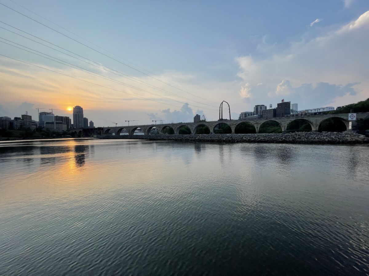
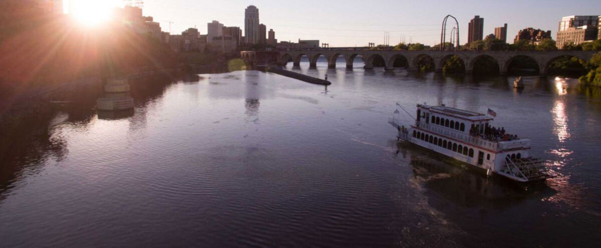
The Stone Arch Bridge
Built in 1882-83 by James J. Hill’s Minneapolis Union Railway Company, the Stone Arch Bridge is recognized as a National Civil Engineering Landmark. The bridge provides a link between Father Hennepin Bluffs Park on the east bank, and Mill Ruins Park and West River Parkway on the west bank.
In 1994 the bridge was converted into a pedestrian and bike trail and offers a panoramic view of St. Anthony Falls.
Named winner of 2008 Best Place to Take Out-of-Town Guests in City Pages’ ”Best of the Twin Cities.”

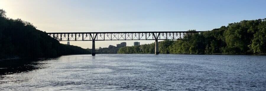
The 10th Ave Bridge
This bridge is 2,921 feet long. This includes the two main arches which span 265-1/2 feet, two smaller side arches of 93 feet, and a number of smaller concrete girder spans. The main arches had a vertical clearance of 110 feet above the Mississippi River, making it the highest bridge in the city of Minneapolis. The bridge was built by the city itself between June, 1926, and October, 1929. The work was accomplished using day labor. The official dedication ceremony was held in September of 1929.
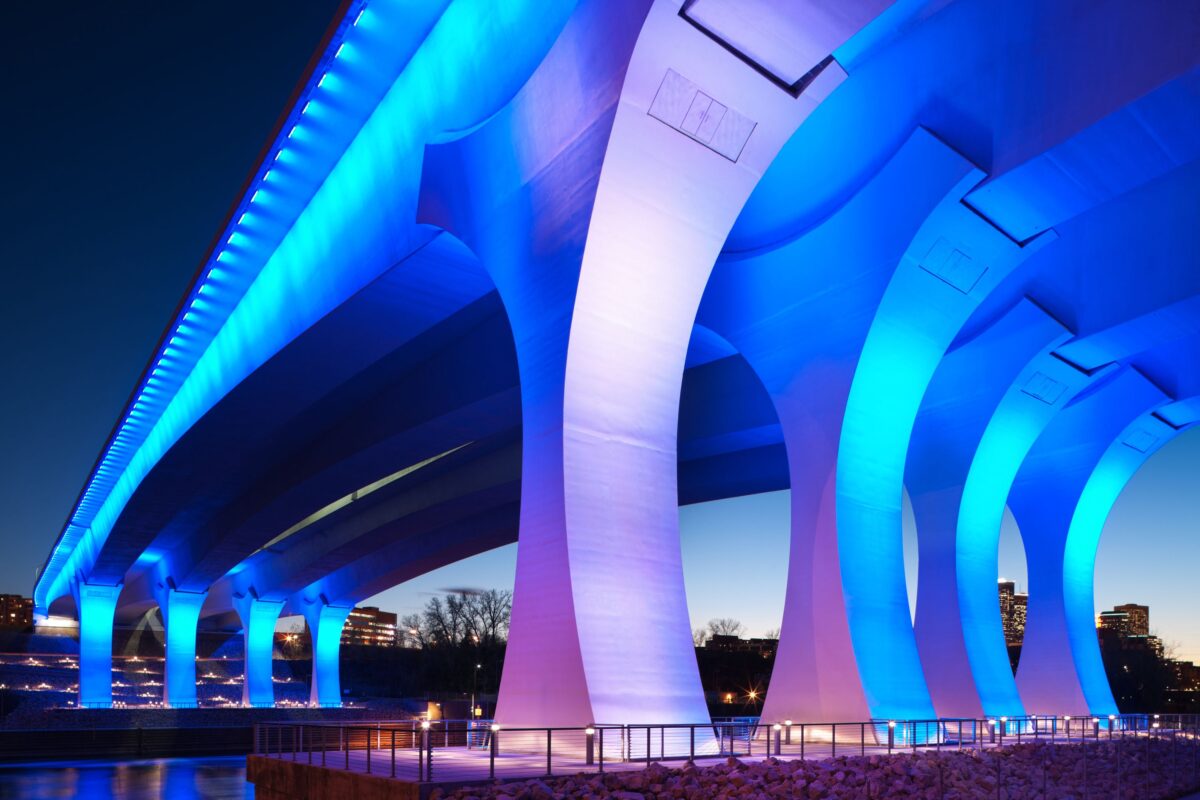
The “NEW” 35W Bridge
The replacement of the collapsed I-35W Mississippi River bridge crosses the Mississippi River at the same location as the original bridge, and carries north-south traffic on Interstate Highway 35W. It was constructed on an accelerated schedule, because of the highway’s function as a vital link for carrying commuters and truck freight.
Mn/DOT announced on September 19, 2007, that Flatiron Constructors and Manson Construction Company would build the replacement bridge for USD $234 million. The I-35W Saint Anthony Falls Bridge was opened to the public on September 18, 2008, at 5 a.m
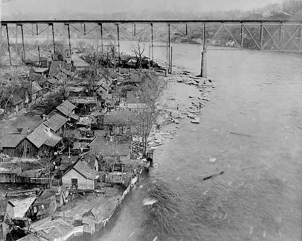
Bohemian Flats Park
“Bohemian Flats” is the name given to a colorful and vibrant former residential area of Minneapolis, Minnesota. Laying southeast of downtown just around a river bend from St. Anthony Falls, the area was surrounded by limestone bluffs along the west bank of the Mississippi River. About the time Minneapolis was incorporated (1867), immigrants seeking employment in the city or at the mills at St. Anthony began settling there. In 1884, the Washington Avenue Bridge was constructed over the area, linking central Minneapolis with the campus of the University of Minnesota, on the east bank of the river. By 1900, the 100 homes, a few stores, and a church created what many described as an Old World-style village below the University.
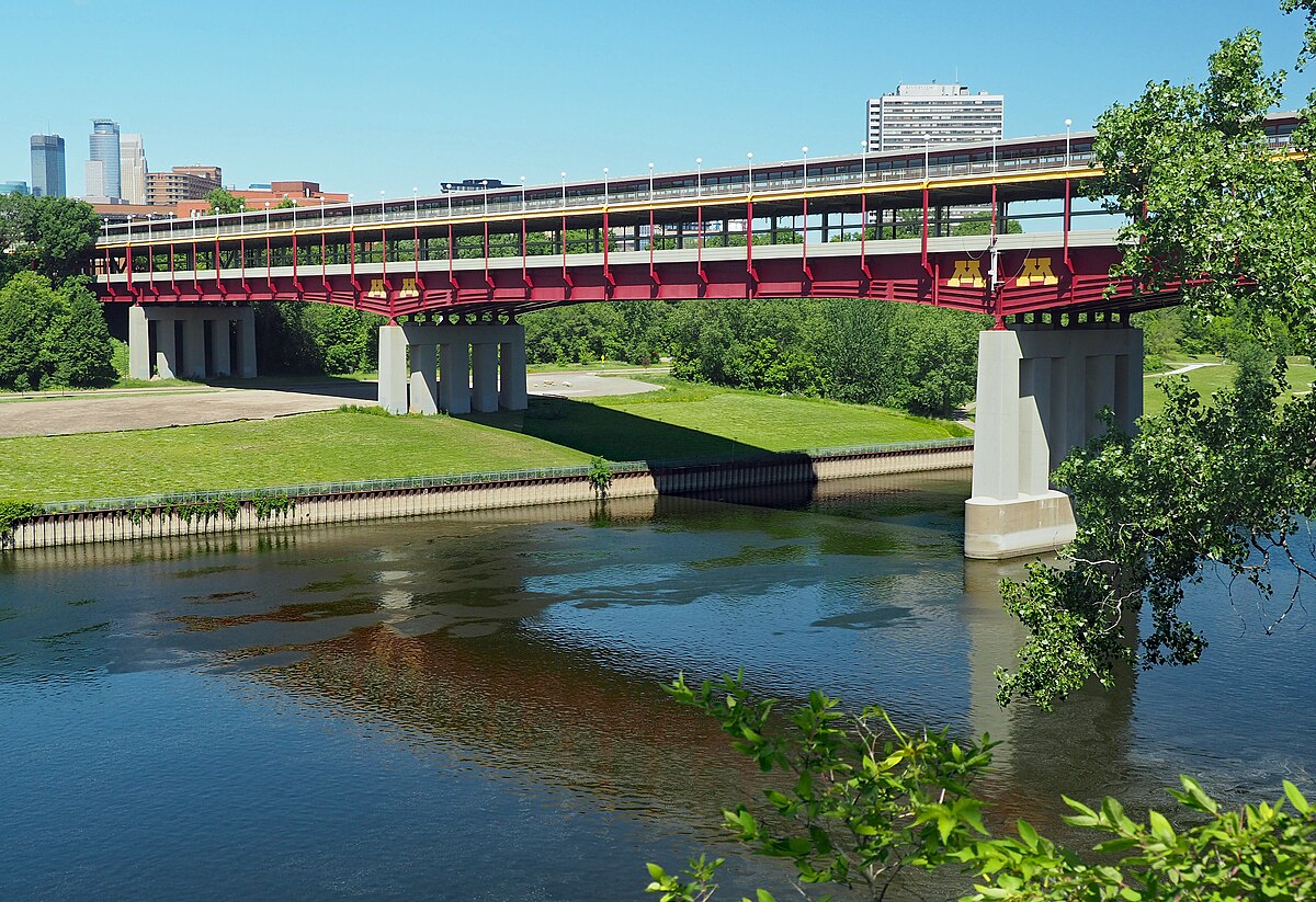
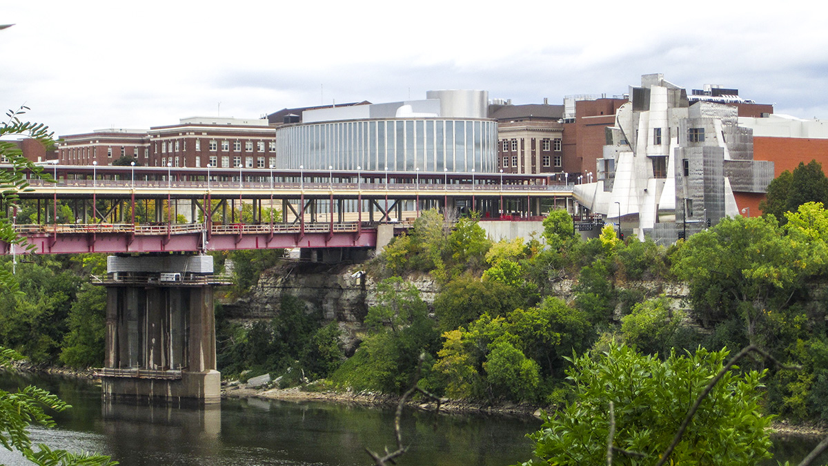
The Washington Avenue Bridge, or “U of M Bridge”
The Washington Avenue bridge was built in 1965. It is a large steel plate girder bridge with a main span of 251 feet. A plate girder bridge is built with large steel beams that are fabricated in a steel shop as opposed to being forged or rolled in a steel mill. This allows engineers to design thicker and thinner spots in the girders to meet the load requirements. A second deck was built on the bridge to be used as a pedestrian walkway for the University of Minnesota, which was just starting to build a large complex on the west side of the Mississippi River. The Washington Avenue bridge was painted grey when it was built. The upper deck was painted in the university colors of maroon and gold in the late 1990s. The rest of the structure was painted school colors in the early 2000s. According to the Wikipedia article, that effort was tedious and slow due to the old paint containing lead, which had to be removed, collected, and disposed of. The end result is a colorful signature structure for the university, which happens to sit next to the Frank Gehry designed Weisman Art Museum, another even more stunning signature structure at the University of Minnesota.
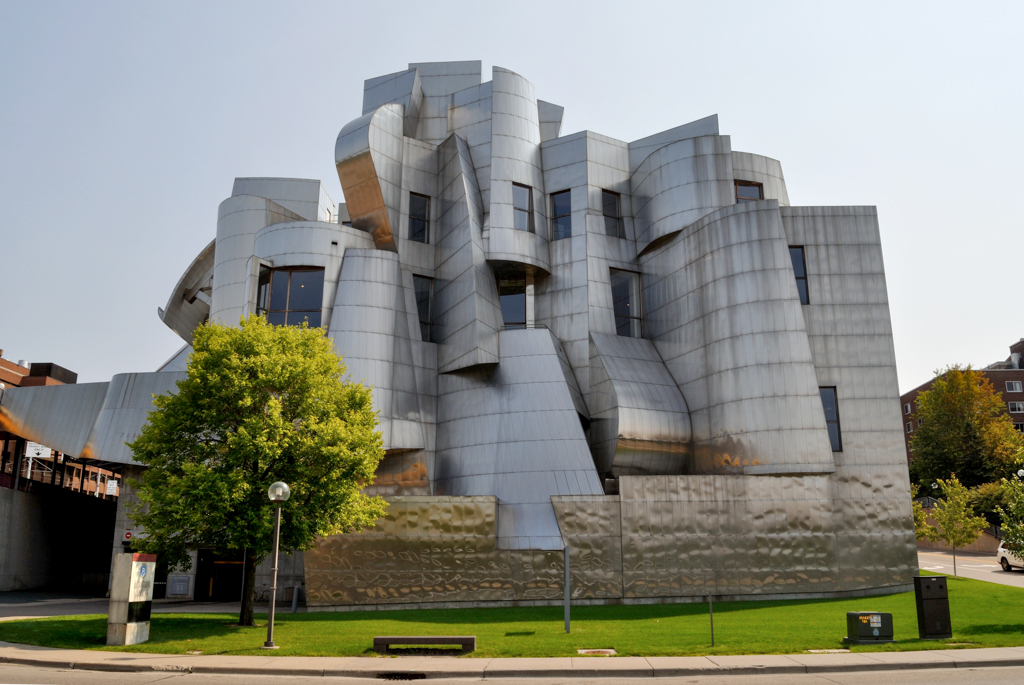
Weisman Art Museum
The building, designed by renowned architect Frank Gehry,was completed in 1993. The stainless steel skin was fabricated and installed by the A. Zahner Company, a frequent collaborator with Gehry’s office.
It is one of the major landmarks on campus, situated on a bluff overlooking the Mississippi River at the east end of the Washington Avenue Bridge. The building presents two faces, depending on which side it is viewed from. From the campus side, it presents a brick facade that blends with the existing brick and sandstone buildings. On the opposite side, the museum is a playground of curving and angular brushed steel sheets. This side is an abstraction of a waterfall and a fish.
University of Minnesota Twin Cities Campus Located on the East Bank
University of Minnesota–Twin Cities is a public institution that was founded in 1851. It has a total undergraduate enrollment of 34,812, its setting is urban, and the campus size is 1,204 acres. It utilizes a semester-based academic calendar. University of Minnesota–Twin Cities’s ranking in the 2013 edition of Best Colleges is National Universities, 68. Its in-state tuition and fees are $13,022 (2011-12); out-of-state tuition and fees are $18,022 (2011-12).
Other Interesting River Facts
Just to the North of the Upper St. Anthony Falls is the Broadway Bridge. This is significant as it marks the exact point at which the 45 parallel crosses the globe. The bridge is placed at the 45 degree North latitude mark, exactly half-way between the Equator and the North Pole.
The area just north of the Upper St. Anthony Falls, marks the head of commercial navigation for entire commercial portion of the Mississippi River. Upstream, is 432 miles to the official headwaters of the Mississippi River at Lake Itasca State Park. Downstream, is 1807 miles to the Gulf of Mexico. The entire 1807 miles of navigable Mississippi River is maintained by the U.S. Army Corp of Engineers which maintains the locks and dams as well as the channel to a minimum of 9 feet depth.
Plan Your Next Event With Us!
Thank you for considering Paradise Charter Cruises & The Minneapolis Queen for your event. Please provide your contact information and specific needs below. Our team will respond promptly. We look forward to working with you!