Lake Minnetonka History
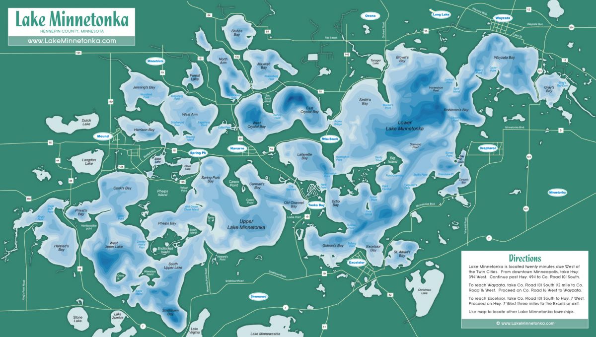
ISLANDS: The number of islands in Lake Minnetonka varies according to the different definitions of islands. The 1993-revised U.S. Geological Survey topographic maps lists 38 islands. The 1944 Hudson’s Indexed Map of Lake Minnetonka and a 1964 map made by the Hennepin County Highway department lists 23 islands. Dredging and filling of the lake’s original features has created, connected and obliterated islands.
STATISTICS: The lake is made up of a number of a series of bays, points and islands with 31 interconnecting channels covering 22.2 square miles of water (14,043 acres) and 125 miles of main lake shoreline not counting islands and channels
- The drainage extends over 123 square miles; the deepest point is Crystal Bay (101 feet).
- 11 miles long,
- 6 miles wide
- 14,310 acres of water
- 101 feet deep (Crystal Bay)
- 125 miles of shoreline (some older statistics list 110 miles)
- Contains 15 lakes of 3 different kinds
- Formed by melting ice blocks in glacial moraines 15,000 years ago
- 929.4 feet above sea level at the outlet, Grays Bay dam
- 130,340,400,000 gallons or 400,000 acre feet water capacity
- 10.9 miles greatest length (Halsteds Bay to Grays Bay)
- 30 feet average depth
- April 12 – 17 is range of average ice-out dates
- 28 inches maximum ice thickness
- 20 – 24 inches average ice thickness
- 123 square miles is area of watershed, including Minnetonka
- 922.7 feet above sea level modern low water level, December 20, 1937
- 931.43 feet above sea level modern high water level, Sept. 12, 1951
Plan Your Next Event With Us!
Thank you for considering Paradise Charter Cruises & The Minneapolis Queen for your event. Please provide your contact information and specific needs below. Our team will respond promptly. We look forward to working with you!